Geological heritage sites

Geopark heritage

Geological heritage sites

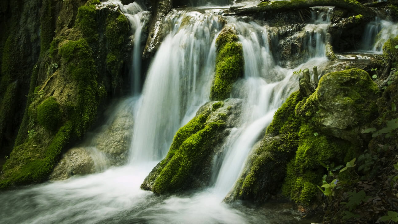
This part of Serbia is especially distinguished by a large number of caves and overgrowth, and its uniqueness is complemented by beautiful waterfalls of the Djerdap UNESCO Global Geopark

While the easternmost part of the Djerdap UNESCO Global Geopark represents a rim of the Dacian basin, most of the Geopark’s territory belongs to the Carpathians and the Balkan Mountains of eastern Serbia. These mountain ranges stand for the northern branch of Alpine belt, formed under highly varied geological conditions, including intensive uplifting, fracturing, secondary erosion modification and intensive karstification processes.

The Geopark area has a long geological history. The oldest rocks, exposed on six geosites, are from the Upper Proterozoic. Various Paleozoic units outcrop on seven geosites.

In the Jurassic, the entire area was invaded by marine transgression and the sedimentation cycle continued there until the beginning of the Upper Cretaceous. Therefore, a vast majority of geosites are developed in Mesozoic (Jurassic to Lower Cretaceous) units. Additionally, four geosites are located in Neogene and five geosites in Quaternary formations.

The majority of geosites are dedicated to representative rock exposures/outcrops and karst landforms (caves, natural arches, karst springs, waterfalls), as well as to beautiful viewpoints in the Djerdap area.

Selected geological heritage sites

List of geological heritage sites on the territory of the Djerdap Geopark

No Site name Description Type Protection status
No 1
Site name Dedine
Description Exposure of the Upper Jurassic and Lower Cretaceous sediments, Golubac Mts.
Type G
Protection status NP3
No 2
Site name Ridan – Golubac
Description The Lower Cretaceous (Urgonian) reefal limestones with typical microfossil assemblage, Ridan settlement, Golubac (nationally important geosite)
Type G
Protection status NP1
No 3
Site name Beg Bunar
Description Karst spring and waterfall, Golubac vicinity
Type G
Protection status NP1
No 4
Site name Rakovica
Description Middle Jurassic sediments with fossil macrofauna, Rakovica hamlet, Brnjica River Gorge
Type G
Protection status NP3
No 5
Site name Brnjica Quarry
Description Part of granitoid massif, Brnjica village
Type G
Protection status NP2
No 6
Site name Turski Potok
Description Miocene-Pliocene deposits with remains of fossil plants, Dobra village area
Type G
Protection status NP3
No 7
Site name Homolje Crystalline
Description Outcrop of Proterozoic metamorphic rocks, Dobra village area
Type G
Protection status NP3
No 8
Site name Leva Reka
Description Exposure of Carboniferous black phyllites
Type G
Protection status NP3
No 9
Site name Crni Vrh
Description Viewpoint (624 m a.s.l.), Jurassic-Cretaceous & Neogene fossiliferous deposits, Brnjica River Gorge
Type LV, G
Protection status NP2
No 10
Site name Pesača – Tunnel 17
Description Representative exposure of continual Jurassic succession in the Southern Carpathians with abundant fossils (brachiopods, bivalves, ammonites and belemnites), Pesača road section (internationally important geosite)
Type G
Protection status NP1
No 11
Site name Sokolovac
Description The most prominent peak (625 m a.s.l.) in the Gospodjin Vir Gorge
Type LV
Protection status NP1
No 12
Site name Boljetinska Reka Gorge
Description Lateral extension of Jurassic-Lower Cretaceous sediments from the Greben ridge; the first protected geoheritage site in Djerdap area (nationally important geosite)
Type G
Protection status NP2
No 13
Site name Boljetinsko Brdo
Description Outcrop of the Lower Cretaceous deepwater sediments with ammonites (internationally important geosite)
Type GM, G
Protection status NP3
No 14
Site name Hladne Vode
Description Lower Cretaceous (Aptian-Albian) fossiliferous sediments, Hladne Vode area
Type G
Protection status NP2
No 15
Site name Greben
Description Instructive exposure of Jurassic-Lower Cretaceous succession; typical profile of “Klaus beds” (internationally important geosite)
Type G, LV
Protection status NP3
No 16
Site name Šomrda
Description A prominent peak of the eponymous mountain (803 m a.s.l.); Precambrian, Permian and Jurassic fossiliferous rocks, Boljetin and Dobra villages area
Type G, LV
Protection status NP2
No 17
Site name Kovilovo
Description Small hill (358 m a.s.l.) and viewpoint to Donji Milanovac valley; metamorphic rocks
Type G, LV
Protection status NP1
No 18
Site name Kapetan Mišin Breg
Description Viewpoint toward the middle part of the Djerdap Gorge
Type LV
Protection status NP3
No 19
Site name Old Donji Milanovac
Description Lower Cretaceous sediments with ammonites
Type G
Protection status NP3
No 20
Site name Traces of the Carpathian Strait
Description Miocene fossiliferous sediments, remnants of the trans-Carpathian strait system; entrance to Donji Milanovac (nationally important geosite)
Type G
Protection status NP3
No 21
Site name Klokočevac
Description Reddish quartz porphyries, Klokočevac village
Type G
Protection status NP3
No 22
Site name Tectonic Nappe Golubinje
Description Proterozoic crystalline schists, Golubinje village
Type G
Protection status NP3
No 23
Site name Ploče – Mali Kazan
Description Leveled karst plateau with dolines
Type GM, LV
Protection status NP1
No 24
Site name Veliki Štrbac
Description The highest peak of Miroč Mt. (768 m a.s.l.), above Mali Kazan Gorge
Type LV, GM
Protection status NP1
No 25
Site name Mali Štrbac
Description A prominent peak of Miroč Mt. (626 m a.s.l) with submerged karst spring at its foothill
Type LV, GM, H
Protection status NP1
No 26
Site name Golo Brdo – Veliki Kazan
Description Exposure of the Jurassic and Lower Cretaceous limestones, Golo Brdo road section
Type G, LV
Protection status NP1
No 27
Site name Đevrin
Description Impressive peak of the Đevrin hill (434 m a.s.l.), part of the Đevrin fault zone, one of the most important fault system in the Southern Carpathians, Sip Gorge
Type GM, G, LV
Protection status NP3
No 28
Site name “Sinaia beds” – Kašajna
Description Lower Cretaceous flysch-type rocks, Kašajna River
Type G
Protection status NP3
No 29
Site name Danube terrace near Kladušnica
Description Sediments of river terrace, one of the incision phases of the Danube River into the Southern Carpathians’ rim, Kladušnica villageКладушница
Type G
Protection status NP3
No 30
Site name Crnajka
Description Middle Jurassic (Bathonian) sediments, Crnajka village
Type G
Protection status NP3
No 31
Site name Miloševa Kula
Description Paleozoic metasediments with marble lenses, Miloševa Kula-Crnajka road section
Type G
Protection status NP3
No 32
Site name Peridotites of Miroč
Description Part of ultramafic nappe system, Miroč Mt. (nationally important geosite)
Type G
Protection status NP2
No 33
Site name Tumane Tufa
Description Karst spring with tufa accumulation, nearby Tumane Monastery
Type GM, H
Protection status NM
No 34
Site name Beli Izvorac Tufa
Description Karst spring with waterfalls and tufa accumulation
Type GM, H
Protection status NM
No 35
Site name Djerdap Gorge
Description Complex area with diverse natural, cultural and historical heritage (internationally important geosite)
Type GM
Protection status NP1, NP2, NP3
No 36
Site name Brnjica River Gorge
Description Middle Jurassic fossil-bearing sediments exposed along Brnjica River meandering gorge
Type G, GM
Protection status NP1
No 37
Site name Drenjarski Sistem-Bigar
Description Cave system with 3731 m long passages, Đevrinska Greda ridge
Type GM
Protection status NP3
No 38
Site name Balta Alu Šontu Lake
Description Natural lake formed by slope processes
Type GM
Protection status NP3
No 39
Site name Velika (Podvrška) Čuka
Description Viewpoint (379 m a.s.l.) to Dacian Basin, Podvrška village area
Type GM
Protection status NP3
No 40
Site name Pešćera Mare Cave
Description Short, dry cave, with fossilized remains and archaeological artifacts (Iron Age), Gospođin Vir Gorge
Type GM, GA
Protection status NP2
No 41
Site name Tabula Traiana Cave
Description Short cave with remains of the Pleistocene mammal fauna (cave lion, cave hyena, cave bear) and Middle Paleolithic human settlement
Type GM, GA
Protection status NP1
No 42
Site name Bele Vode
Description System of strong, partially submerged karst springs, Kazan Gorge
Type GM, H
Protection status NP2
No 43
Site name Buronov Ponor
Description Ponor cave with two entrances and 3593 m long passages, Miroč Mt.
Type GM, H
Protection status NP3
No 44
Site name Rakin Ponor
Description Deepest cave in Serbia with the total denivelation of -285 m, Miroč Mt. (nationally important geosite)
Type GM, H
Protection status NP3
No 45
Site name Suvi Ponor
Description Ponor cave with 930 m long passages and denivelation of 133 m, Miroč Mt.
Type GM
Protection status NP3
No 46
Site name Gradašnica Cave
Description Spring cave with 529 m explored passages and specific silica concretions (opal & chalcedony) – the first documented occurrence in the Serbian caves, Miroč Mt. (nationally important geosite)
Type GM
Protection status NP3
No 47
Site name Disina Pećina Cave
Description Spring cave with smoothly eroded walls and 366 m long passages, Veliki Greben Mt.
Type GM
Protection status NP3
No 48
Site name Bezimena Pećina Cave
Description Easily accessible unnamed dry cave, Veliki Greben Mt.
Type GM
Protection status NP3
No 49
Site name Pepeljavi Potok Gorge
Description 100 m long gorge with erosional pots and seasonal stream, Đevrinska Greda area
Type GM
Protection status NP3
No 50
Site name Velika Peštera Cave
Description 129 m long tunnel cave, typical for stripe karst, Đevrinska Greda area
Type GM
Protection status NP3
No 51
Site name Miličina Pećina Cave
Description Outflow cave with two entrances and 156 m long passages, Kašajna, Dževrinska Greda area
Type GM
Protection status NP3
No 52
Site name Žuti Krš
Description 355 m long cave with two karst springs; one of them is subthermal (18°C), Dževrinska Greda area
Type GM
Protection status NP3
No 53
Site name Rajkova Pećina Cave
Description One of the longest caves in Serbia, with 2380 m of explored passages; Upper Jurassic massive limestones, Majadanpek area (nationally important geosite)
Type GM
Protection status NM
No 54
Site name Stone Arch Šuplja Stena
Description Natural stonebridge on the Valja Prerast River, Majdanpek area
Type GM
Protection status NM
No 55
Site name Vratna Stone Arches
Description Vratna River valley with three natural stonebridges: Mala Prerast, Velika Prerast and Suva Prerast, Vratna village area (internationally important geosite)
Type GM
Protection status NM
No 56
Site name Zamna Tunnel Cave
Description Tunnel cave with two daylight holes is an example of the final phases of speleomorphological evolution, Plavna village area
Type GM
Protection status NM
No 57
Site name Blederija
Description Karst area with waterfalls and two main springs; one of them is subthermal, Miroč Mt.
Type GM, H
Protection status NM
No 58
Site name Nadanova
Description Exposure of Upper Cretaceous (Cenomanian-Middle Turonian) schistose rocks, opposite to Nadanova village in Romania
Type G
Protection status NP3
No 59
Site name Tekija Alluvial Fan
Description Big alluvial fan formed by torrential floods and mudflows, Tekija
Type GM, H
Protection status NP3
No 60
Site name Korešin Potok
Description Precambrian-Ordovician gabbroic rocks overlain by Silurian-Devonian sandstones, Mosna village (nationally important geosite)
Type G
Protection status NP3
No 61
Site name Rudna Glava
Description Oldest copper exploitation and mining in Europe, Rudna Glava village
Type GA
Protection status NP3
No 62
Site name Canetova Pećina Cave
Description Short dry cave with anastomosing passages, its origin is probably hydrothermal, Zamna River gorge
Type GM
Protection status NP3
No 63
Site name Sokolovica Caves
Description Two spring caves, outflow points of the karst hydrogeological system in Cvetanovac ponor area, Miroč Mt.
Type GM, H
Protection status NM

Type: geological (G), geomorphological (GM), geoarchaeological (GA), hydrological (H), landscapes-viewpoints (LV)

Protection status: situated within the Djerdap National Park, in the 1st zone of protection (NP1), situated within the Djerdap National Park, in the 2nd zone of protection (NP2), situated within the Djerdap National Park, in the 3rd zone of protection (NP3), natural monument (NM)

The following

Natural heritage sites

Contact

Public Enterprise
Djerdap National Park
st. Kralja Petra I No. 14a
19220 Donji Milanovac, Serbia
E-mail: office@npdjerdap.rs
Headquarter: +381 (0)30 215 0070

Copyright © 2020 Djerdap Geopark. All rights reserved.
Shopping Basket

The attractiveness of Lepenski Vir has been recognized by, among many, companies, organizations and artists, to whom this locality served as inspiration and trade mark. Many prominent painters, among whom are Mario Maskareli, Milic od Macve, Vojislav Zizic, Dragan Mojovic, Dragan Stojkov, Bratislav Stojanovic, Marica Radojcic, Mirjana Lehner and many others, transformed the fascinating monumental sculptures into first class works of art.

Along with them were famous writers who have put the impression of Lepenski Vir to paper: Milorad Pavic, Miodrag Pavlovic with the works Pevanja na Viru (Singing in the Rain), Nova pevanja na Viru (New singing in the rain), the essay Lepenski Vir: Sculpture and myth (Skulptura i mit), as well as Dusan Matic, Zoran Milic, Ivan Gadjanski. For the children’s book of Jovan Janicijevic, Vodena vila iz Lepenskog Vira (Water Fairy from Lepenski Vir) and Klinče iz Vinče (Child from Vinca), the two localities served as inspiration, both special and fantastic, each in its own way.

The Motive of Lepenski Vir appears on stamps in 2003. One of the most famous monumental stone sculptures found its place on a home made biscuit, which you can get with coffee in many cafes in Serbia. In 1995, the same sculpture served as a trademark of the activity of the Ministry of Culture on the occasion of announcing The Year of Culture, “It is more beautiful with culture“. The sculpture had sunglasses and a smile, and it became a symbol of the cultural rebellion against social values and the position it had in society.

The text downloaded from http://www.narodnimuzej.rs/zanimljivosti/lepenski-vir-in-popular-culture/?lang=en

Широм света познати деликатес кавијар је данас и синоним за луксузан залогај, статусни симбол и храна богатих. Некада је „рибљи ајвар“ (како су га звали ђердапски аласи) био храна сиромашних, радника, рибара и њихове деце, као намаз на црном хлебу.

Јесетарске рибе, од чије се икре израђивао кавијар, ловљене су до изградње ђердапске бране, у Госпођином виру, на Гребену, Јуцу, у Казану и код Сипа. Ђердапски кавијар био је веома цењен на европским трпезама. Организованији начин прераде и промета кавијара започет је 1920. појавом руских емиграната на простору Ђердапа.

У другој половини 20. века Рибарско газдинство „Ђердап“ из Кладова било је једини произвођач кавијара у Југославији који се извозио и у САД.

Споменик природе Тунелска пећина Прераст у кањону Замне („Службени гласник РС“, број 81 од 5. јуна 2020. године) представља геоморфолошки феномен на источној страни Дели Јована, на реци Замни и сврстава се у I категорију заштићеног подручја међународног, националног односно изузетног значаја. Налази се на подручју општине Неготин, укупне површине 39 ha.

Споменик природе Тунелска пећина Прераст у кањону Замне је тунелска речна пећина са сталним речним током. Настала је подземним флувио-крашким усецањем Замне, што је у одмаклој фази еволуције омогућило настанак процеса обрушавања, чиме су у пећини отворена два отвора у таваници (вигледи). Пећина представља јединствен и једноставан пећински канал дужине 155 m, у чијем поду је речно корито Замне. Због два велика отвора у таваници ова тунелска пећина је целом дужином под дневном светлошћу. Захваљујући постојању ових отвора, на улазу и на излазу, пећински тунел има изглед огромне прерасти. Отвори у таваници су удаљени један од другог око 70 m.

Клисура Замне је рефугијално станиште великог броја животињских и биљних врста са очуваном вегетацијом, по чему је изузетно значајно подручје биолошког диверзитета који заслужује заштиту.

Споменик природе Тунелска пећина Прераст у кањону Замне поверен је на управљање Туристичкој организацији општине Неготин.

Cпоменик природе Бигрена акумулација Бели изворац (Службени лист општине Мајданпек број 06-52/4 од 27.12.2006. године), значајан због своје изузетности и очуваности као геоморфолошки објекат површинског крашког рељефа, сврстан је у III категорију као значајно природно добро. Налази се у сливу реке Шашке, на територији општине Мајданпек, укупне површине 6 ha.

У долини Белог изворца постоје две акумулације бигра различите старости, таложене једна преко друге. Ово природно добро има велики број облика, појава и процеса, који је водоток Белог изворца формирао у наталоженим наслагама бигра, низводно од изворишта поменутог водотока. На релативно малом простору (око 300 m) налази се велики водопад, висине 16 m.

Испод водопада, понирањем воде кроз бигар, образован је пећински канал дуг 13 m и широк 4 m, отворен са једне и друге стране. Преталожавањем бигра у пећини су образовани саливи и сталактити од чисте беле сиге. Низводно од водопада, у кориту потока, постоје бројне преграде од бигра, иза којих су образоване бигрене акумулације језерца пречника до 10 m и дубине 2-3 m. Преко преграда поток се слива у виду слапова и мањих водопада, међу којима су два висока 5 m.

Споменик природе Бигрена акумулација Бели изворац поверен је на управљање Туристичкој организацији општине Mајданпек.

Споменик природе Бигрена акумулација код манастира Тумане (Службени лист општине Голубац број 633-2/2009) представља геоморфолошко-хидролошки објекат стављен под заштиту ради очувања као посебног природног феномена и сврстава се у III категорију као значајно природно добро. Налази се на територији општине Голубац, укупне површине 8550 m2.

Споменик природе Бигрена акумулација код манастира Тумане се налази у средишњем делу тока Каменице, 1,1 km узводно од ушћа у Туманску реку, на 250 m н. в. и у подножју десне долинске странe. На овом подручју, малом простору у дужини од око 200 m, јавља се већи број морфолошких облика и то слап висине 14 м, низ мањих слапова, прелива и бигрених када.

Посебност Споменика природе Бигрена акумулација код манастира Тумане чине: испосница у самом бигру, јединствена у Србији, чесма на којој се приносе дарови душама умрлих, стара букова и храстова шума.

Бигрена акумулација код манастира Тумане је под старатељством Туристичке организације општине Голубац.

Споменика природе Бледерија (Уредба Владе Републике Србије 05 број 110-8258/2019-2 од 20. децембра 2019. године, „Службени гласник РС“, број 93 од 26. децембра 2019. године) проглашено је заштићеним подручјем II категорије – регионалног, односно великог значаја. Споменик природе „Бледерија” налази се на територији општине Кладово, укупне површине 398 ha.

Подручје око речице Бледерије на југозападном ободу регије дунавског Кључа, југозападно од Кладова, атар села Река, заштићено је да би се очувало богатство и разноврсност облика геодиверзитета: извориште Бледерије разбијеног типа са четири места истицања врела, два акумулативна водопада, од којих је низводнији висине око 7 m и због своје лепоте и богатства воде представља објекат хидролошког наслеђа Србије; затим велике акумулације бигра у доњем току, врелске пећине Соколовице, са истоименим повременим врелом гравитационог типа и периодским током који је низводно од локалитета Град до састава са токовима Суваје и Бледерије усекао живописну кречњачку клисурицу, са неколико изразитих сужења и слапова.

На подручју Споменика природе Бледерија налази се фрагментно очувана шумска вегетација у комплементарности са биљним и животињским светом.

Споменик природе Бледерија поверен је на управљање Туристичкој организацији општине Кладово.

Споменик природе Прераст Шупља стена (Уредба Владе Републике Србије 05 број 110-777/2019-1 од 23. маја 2019. године, „Службени гласник РС“, број 36 од 24. маја 2019. године) заштићен је ради очувања геоморфолошких, хидрографских и ботаничких вредности масивног природног каменог моста – прераста, као природног феномена флувиокраса окруженог широким појасом шуме, висине од 9,5 м изнад корита реке Прераст. Сврстава се у I категорију заштићеног подручја међународног и националног, односно изузетног значаја. Споменик природе се налази на територији општине Мајданпек, укупне површине је око 8 ha.

У просторном оквиру заштићеног природног добра издваја се више различитих геоморфолошких и хидролошких вредности. Доминантно место припада каменом мосту, прерасти, феномену флувиокраса источне Србије. У кречњакој зони, заступљен је типичан крашки рељеф са пуно вртача, стрмих кршевитих литица и мањих спелеолошких објеката. У кориту речице Прераст на улазу у Шупљу стену са леве стране налази се мањи понор, чија се вода појављује на излазу из прераста. Поред наведеног, постоји и мањи извор који избија из кречњачке пукотине. Прераст Шупља стена је посебно значајан због своје изузетности и очуваности као геоморфолошки објекат. Прераст је усечена у виду грандиозног природног каменог моста у кречњацима. Отвор прерасти при дну, у висини речног корита износи 9,5 m. Висина отвора лука је 29,5 – 34 m, а висина до горње ивице лука износи 44,8 m.

Споменик природе Прераст Шупља стена поверен је на управљање Туристичкој организацији општине Мајданпек.

Качамак или мамаљига традиционално јело у Ђердапу спрема се од топле воде, кукурузног брашна, масти и соли. Из котлића се излива у тепсије и качамак добија округао изглед. Служи се са млеком, сиром, јогуртом, испрженим црним луком, сушеном белом рибом, сланином и сече танким концем.

Припремао се раније и као посластица када се ређао ред качамака и ред џема, након чега се посипао прженим презлама. Гушће справљен и запечен под црепуљом користио се као замена за хлеб.

Боравећи за време II светског рата изнад села Бољетин, припадници енглеске војне мисије послужени су влашким качамаком, а шеф мисије Џаспар Рутам записао је да су за јело добили „округлу жуту торту која није била слатка“.

Рано енеолитски рудник Рудна Глава код Мајданпека (5000. година пне.) пример је најстарије познате технологије бакра. Истражен је 1968-1989. године у оквиру пројекта Старо рударство и металургија средишњег Балкана.

Најстарија рударска технологија, упозната у Рудној Глави, разрешила је недоумице око порекла примарног рударског и минералошког знања. Велику умешност старих рудара на Рудној Глави потврђују испражњена окна дубине до око 20 метара. Велика серија камених батова, крупних речних облутака од вулканских стена, сведочи о специјализацији примарног каменог алата за различите производне функције.

За уситњавање комада руде употребљавани су различити дрвени клинови, док су алати од јеленског рога служили првенствено за прикупљање већ иситњене руде. Када су исцрпили карбонатне минерале бакра, малахит и азурит, доступне технологији којом су располагали, винчански рудари раног енеолита, напустили су овај рудник.

Ово скромно лежиште гвоздене и бакарне руде – магнетита и халкопирита – поново су користили, са новом технологијом, римски рудари – робови у 3. веку после Христа.

(Текст др Борислава Јовановића и мр Александра Петровића преузет са проспекта у издању Завода за уџбенике и наставна средства РС, Београд, 1998)

Активних вулкана данас нема у Србији и вероватноћа да ће их у будућности бити мери се хиљадама година. Иако их данас нема, подручје Србије је у геолошкој историји било веома активно, а трагови некадашњих вулкана и данас постоје.

Различитих вулканских активности било је од најстаријег геолошког времена, али је детаљнија реконструкција могућа само за последњих 300 милиона година. То обухвата вулкане каснопалеозојске (пре 300 милиона година), тријаске (пре 220 милиона година), јурске (пре 150 милиона година), горњокредне (пре 90 милиона година) и терцијарне (пре 65 милиона година) старости.

На подручју источне Србије крајем палеозоика одвијао се субаерски вулканизам, а ретки продукти ових ерупција у Србији као мали остаци излива лаве и вулканокластита јављају се код Бољетина, али су ове стене данас углавном под водом. Најупечатљивији су риолитски остаци Трескавца на румунској обали Дунава, преко пута Лепенског Вира, а посебна занимљивост је да су комади ових вулканских стена, посебно они од силификованог вулканског стакла, коришћени у Лепенском Виру у индустрији окресаног камена.

У тимочком подручју данас су присутни бројни остаци горњокредних стратовулкана: Црни врх, Тилва Њагра, околина села Јасиково и Влаоле, околина Брестовачке Бање, Чока Марин и друга места. На пределу где се некад уздизао борски стратовулкан Тилва Рош данас је површински коп пречника од неколико километара.

Атрактивност Лепенског Вира препознале су, међу многима, и компаније, организације и уметници, којима је овај локалитет послужио као инспирација или заштитни знак.

Многи реномирани сликари, од којих треба поменути: Марија Маскарелија, Милића од Мачве, Војислава Жижића, Драгана Мојовића, Драгана Стојкова, Братислава Стојановића, Марицу Радојчић, Мирјану Лехнер и многе друге, преточили су фасцинантност монументалних скулптура у врхунска уметничка дела. Раме уз раме с њима, стајали су познати књижевници, који су у речи преточили импресију Лепенског Вира: Милорад Павић, Миодраг Павловић са делима Певања на Виру, Нова певања на Виру, есејем Лепенски Вир: скулптура и мит, затим Душан Матић, Зоран Милић, Иван Гађански. За дечију књижицу Јована Јанићијевића, Водена вила из Лепенског Вира и клинче из Винче, два локалитета су послужила као инспирација, оба посебна и фантастична, сваки на свој начин.

Мотив Лепенског Вира појављује се на поштанским маркама 2003. године. Једна од најпознатијих монументалних камених скулптура налази се на популарном домаћем кексу, који можете добити уз кафу у многим кафићима у Србији. Године 1995, иста скулптура послужила је као заштитни знак акције Министарства културе поводом проглашења Године културе, „Лепше је са културом“. Скулптури су додали наочаре за сунце и осмех, а она је постала симбол бунта културе против социјалних вредности и положаја који је заузимала у друштву.

Tекст преузет са http://www.narodnimuzej.rs/zanimljivosti/lepenski-vir-u-popularnoj-kulturi/

The early Chalcolithic mine Rudna Glava near Majdanpek (5000 BC) is an example of the oldest known copper mining technologies. It was under an archaeological investigation from 1968 to 1989, within the project “Old Mining and Metallurgy of the Central Balkans”.

The oldest mining technology found in Rudna Glava has resolved doubts about the origin of primal mining/mineralogical knowledge. Up to 20 m deep mine shafts confirm great technical skills of the early miners at Rudna Glava. Numerous massive pebbles of volcanic origin, obtained from the local river deposits and used as heavy mining hammers, indicate the development of early stone tools for different production functions.

Various wooden tools were used for crushing the ore, while deer antler tools were used primarily to collect the grinded material. After the exhaustion of copper-carbonate minerals (malachite and azurite), which were the only minerals compatible with the technology at the time, the early Chalcolithic miners of the Vinča culture abandoned the mine. This minor deposit of iron and copper, with magnetite and chalcopyrite ore, was exploited again in the 3rd century AD, using new technologies and workforce of Roman slaves.

(Dr. B. Jovanović, MA A. Petrović, Institute for Textbooks and Teaching Aids of RS, Belgrade, 1998)

The Natural Monument “Natural Arches in Vratna Gorge” (“Official Gazette of RS”, No. 99/2014) is a geomorphological phenomenon, declared a protected area of 1st category, of national and exceptional importance. It is located in the municipality of Negotin, with a total area of 144.75 ha.

It represents a unique form of underground and surface karst morphology created by a local sink of the river flow and a partial collapse of the through cave’s ceiling. Along 3 km of the river flow, three natural arches have been formed over the Vratna River: Suva Prerast, Velika Prerast and Mala Prerast.

The area of the Natural Monument “Natural Arches in Vratna Gorge” is protected in order to preserve specific forest vegetation, i.e. a complex community characterized by the presence of endemic and relic (tertiary) species, as well as the exceptional diversity of fauna.

The management over this natural monument is entrusted to the State Enterprise for Forest Management “Srbijašume”, Belgrade.

The Natural Monument “Prerast Tunel Cave in Zamna Gorge” (“Official Gazette of RS”, No. 81/2020) is a geomorphological phenomenon on the east side of Deli Jovan Mountain, on the Zamna River and is classified as a protected area of 1st category of international, national and exceptional significance. It is located in the municipality of Negotin, with a total area of 39.50 ha.

The Natural Monument “Prerast Tunel Cave in Zamna Gorge” is a tunnel cave with a perennial stream. It has been formed by the subterranean fluvio-karstic incision of the Zamna River, which enabled the collapse processes in an advanced phase of evolution, resulting in the formation of two openings in the cave ceiling (skylights).

The cave is represented with a single, simple and 155 m long cave passage, which host the riverbed of Zamna River. Due to the two large openings in the ceiling, which are around 70 m apart, this tunnel cave is under daylight along its entire length. Because of the existence of these openings, at the entrance and at the exit of the cave passage, the cave resembles a huge natural arch. The Zamna River Gorge is a refugium of a large number of animal and plant species, with well-preserved vegetation, making it an outstandingly important area of biodiversity, deserving to be protected.

The management over the Natural Monument “Prerast Tunel Cave in Zamna Gorge” is entrusted to the Tourist Organisation of the Municipality of Negotin.

The Natural Monument “Beli Izvorac Tufa Accumulation” (“Official Gazette of the Municipality of Majdanpek”, No. 29/2006) is a unique geomorphological and hydrological phenomenon of the surface karst relief.

A part of the Beli Izvorac Creek, from its source to the elevation of 278 m a.s.l, with a length of 300 m and the adjoining tufa accumulations, is protected as a natural monument and declared a significant natural resource, i.e. a natural resource of 3rd category. It is located in the municipality of Majdanpek, with a total area of 6.02 ha.

It is protected in order to preserve a large number of fluvio-karstic landforms, phenomena and processes (karst spring; large, 16 m high waterfall; several small waterfalls and cascades; numerous tufa rimstones with rimstone pools; etc) which have been formed in the tufa accumulations by the Beli Izvorac Creek, in a relatively small area downstream from the spring.

The management over the Natural Monument “Beli Izvorac Tufa Accumulation” is entrusted to the Tourist Organisation of the Municipality of Majdanpek.

The Natural Monument “Tufa Accumulation near Tumane Monastery” (“Official Gazette of the Municipality of Golubac”, No. 1/2009) is a geomorphological and hydrological object of the surface karst relief near the Tumane Monastery.

It consists of a tufa accumulation with a number of geomorphological forms and is declared a significant natural resource of 3rd category. Located in the municipality of Golubac, with a total area of 8550 m2, it occupies the central part of the Kamenica Creek, at 250 m a.s.l. or 1.1 km upstream from the confluence of the Kamenica Creek and Tumanska Reka River.

This natural phenomenon, having a terraced, fan-shaped form and height of approximately 14 m, is a palaeogeographic indicator valuable for the reconstruction of climate, vegetation and geomorphological processes in the past. 14 m high waterfall and a series of small cascades, barrages and rimstone pools occupy a small area, at a length of around 200 m. Special features of this natural monument are: a hermitage carved out of tufa (which is unique in Serbia), a fountain where gifts are offered for the repose of souls, old beech and oak forests.

The management over the Natural Monument “Tufa Accumulation near Tumane Monastery” is entrusted to the Tourist Organisation of Golubac.

The Natural Monument “Šuplja Stena Natural Arch” (“Official Gazette of RS”, No. 36/2019) is a geomorphological and hydrological phenomenon on the Valja Prerast River, which is classified as a protected area of 1st category of international, national and exceptional significance. It is located in the municipality of Majdanpek, with a total area of 8.27 ha.

The Natural Monument “Šuplja Stena Natural Arch” is protected in order to preserve the geomorphological, hydrographic and botanical values ​​of the massive natural arch – a fluvio-karstic phenomenon surrounded by a wide forest belt.

A span of the natural arch is 9.5 m, with a height of its lower edge of 29.5-34 m and a height of its upper edge of 44.8 m. A typical karst relief with dolines, limestone cliffs, short caves, a swallet and a karst spring is developed within the protected area.

The management over the Natural Monument “Šuplja Stena Natural Arch” is entrusted to the Tourist Organisation of the Municipality of Majdanpek.

The Natural Monument “Blederija” (“Official Gazette of RS”, No. 93/2019) encompasses the Blederija River on the southwestern rim of the Ključ region and is declared a protected area of 2nd category of regional and high significance. It is located in the municipality of Kladovo, with a total area of ​​398.87 ha.

The Natural Monument “Blederija” is protected in order to preserve the richness and geodiversity of the area: complex source of the Blederija River, with four outflows; two tufa waterfalls, of which the lower one has a height of approximately 7 m and is listed as an object of hydrological heritage of Serbia, due to its beauty and abundance of water; large tufa accumulation in the lower course; spring caves of Sokolovica, with the eponymous intermittent gravity spring and the periodic stream which incised a picturesque limestone gorge downstream of the Grad locality, all the way to the confluence with the Suvaja and Blederija Rivers, with several distinct narrowings and cascades. This area hosts fragmentary preserved forest vegetation, in complementarity with flora and fauna.

The management over the Natural Monument “Blederija” is entrusted to the Tourist Organisation of the Municipality of Kladovo.

Cornmeal porridge (”mamaljiga“ in Wallachian) is a traditional dish in Djerdap area, made of hot water, corn flour, fat and salt. While still hot, it is poured from the cauldron into pans, thus getting a round shape. It can be served with milk, cheese, yogurt, fried onions, dried white fish or bacon.

Instead of a knife, a piece of sewing thread is commonly used to cut cornmeal porridge into slices. It also used to be prepared as a dessert, arranging alternating rows of porridge and jam, with fried breadcrumbs sprinkled on the top. Thickly prepared and baked in a traditional clay oven, it can be used as a substitute for bread.

During their stay near Boljetin village, members of the WWII British military mission were served with cornmeal porridge; the head of the mission, Jasper Rootham, wrote that they were given “a round yellow cake that was not sweet”.

Today, there are no active volcanoes in Serbia and it is not likely that we will see one any time soon. Nonetheless, the territory of Serbia was very active in geological history and traces of former volcanoes still exist. Various volcanic activities go back to a distant geological history, but best evidenced events date back to last 300 million years. These include Upper Paleozoic (300 million years old), Triassic (220 million years old), Jurassic (150 million years old), Upper Cretaceous (90 million years old) and Paleogene volcanoes (65 million years old).

At the end of the Paleozoic, a subaerial volcanism took place in Eastern Serbia. Products of these eruptions, represented with minor lava flows and volcaniclastics near Boljetin village, are scarce and for the most part submerged. The most impressive is the rhyolite lava neck of Mount Trescovăţ on the left Danube’s bank in Romania, just opposite to the Lepenski Vir archaeological site on the Serbian bank. Some of these volcanic rocks, especially silicified volcanic glass, were used for stone carving in the Lepenski Vir culture.

Numerous remnants of Upper Cretaceous stratovolcanoes are still present in the Timok area: Crni Vrh Mountain, Tilva Njagra Mountain, Čoka Marin Hill, as well as in the vicinity Brestovačka Banja Spa and Jasikovo and Vlaole villages. On the location of what used to be Tilva Roš Stratovolcano, today stands an open-pit copper mine, with a diameter of several kilometers.

Caviar is a world-famous delicacy, synonymous with a status symbol, luxury, wealth. However, caviar (or “fish ajvar“, as Djerdap fisherman used to called it) spread on whole-wheat bread was a food of the poor, workers, fishermen and their families.

It was made from roe, harvested from several species of sturgeon; up to the construction of the Djerdap Dam, these fish were caught in several sectors of the Djerdap Gorge: Gospođin Vir, Greben, Juc, Kazan and Sip. Caviar from Djerdap was highly prized across Europe. Well-organized caviar production and trade was established in 1920, with the arrival of Russian emigrants.

By the second half of the 20th century, Đerdap Fish Farm from Kladovo was the only caviar producer in former Yugoslavia and this caviar was exported as far as to the USA.

Споменик природе Прерасти у кањону Вратне („Службени гласник РС“, број 99 од 11. септембра 2014. године) представља геоморфолошки феномен, проглашен заштићеним подручјем I категорије од националног односно изузетног значаја. Налази се на подручју општине Неготин, укупне је површине 144 ha.

Представља јединствен облик подземне и површинске крашке морфологије настао локалним понирањем речног тока и урушавањем делова таванице речне пећине. Над реком Вратном, на дужини од 3 km формирана су три природна камена моста, односно прерасти: Сува прераст, Велика прераст и Мала прераст.

Подручје Споменика природе Прерасти у кањону Вратне стављено је под заштиту ради очувања специфичне шумске вегетације односно мешовитог сложеног састава који карактерише присуство терцијарних и ендемореликтних врста, као и изузетне разноврсности фауне.

Споменик природе Прерасти у кањону Вратне поверен је на управљање Јавном предузећу „Србијашуме” Београд.